
NEWS
The Wilderness Croajingolong Protects Is a Colonial Fuel Load
A 1,000-year lake core shows Gunaikurnai removal thickened Croajingolong into flammable forest, so the wilderness now conserved is the fuel climate ignites.

A 1,000-year lake core from Croajingolong National Park shows eucalypt cover rose fourfold after Gunaikurnai people were driven off Country. The park is a national park, a wilderness, and a UNESCO biosphere. In 2019-20, fire burned through 90 percent of it.
University of Melbourne palaeoecologist Michael-Shawn Fletcher, working with the Gunaikurnai Land and Waters Aboriginal Corporation, says the forest now conserved as untouched nature is a colonial product. Climate did not load that fuel. Removal did, more than a century before human-driven warming.
The Wilderness That Colonisation Built
Croajingolong covers about 87,500 hectares on Victoria’s far-east coast, proclaimed on 26 April 1979. Parks Victoria manages Sandpatch Wilderness (15,600 hectares) and Cape Howe Wilderness (7,100 hectares) inside it. The United Nations listed the coast as a biosphere reserve. People are largely kept out so “nature” can run.
That is the point of the designation, and it is also the trap. Fletcher said Croajingolong “has long been treated as pristine wilderness, yet it is now one of the most fire-prone and repeatedly burnt parts of southeastern Australia.” The 2019-20 Black Summer fires burned more than 1.5 million hectares in Victoria and killed five people. Inside the park, the interval between fires has fallen from about 40 years in the late 1800s to about five years in the most recent decade.
Parks Victoria still lists tracks closed after those fires and later flood damage, and it is rebuilding campgrounds around Mallacoota. The visitor story remains wilderness and escape. The mud record says the canopy above those tracks is not the woodland Gunaikurnai kept.
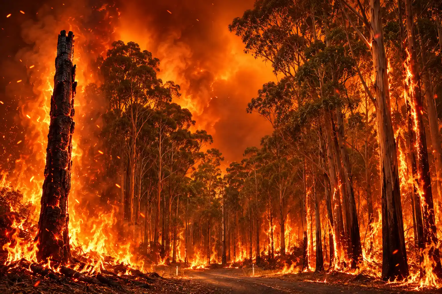
Researchers Pulled a 1,000-Year Core From Purghagoolah
The archive is Purghagoolah, which colonial maps called Lake Elusive. In February 2021 the team lifted a metre-long sediment core from its deepest water. Pollen, charcoal, and mineral grains blown in from about 10,000 square kilometres record what grew, how hot fire ran, and when soil washed off the hills.
Infrared spectra of the charcoal separate cool cultural fire from hot wildfire. Magnetic minerals track erosion. Lead-210 and radiocarbon dates pin the layers in time. The 1,000-year vegetation and fire record is the first of this detail for these temperate eucalypt forests.
THE DATES THAT LOCK THE STORY
- 1788: British invasion begins at Sydney; Gunaikurnai fire still holds East Gippsland as open woodland.
- 1830s to 1860s: Frontier violence and massacres remove Gunaikurnai people from Country and cultural burning stops.
- 1867: Mean change-point in eucalypt cover and charcoal across 5,000 reconstructions of the core.
- 26 April 1979: Croajingolong is proclaimed a national park over a forest that has already thickened.
- 2019-20: Black Summer burns 90 percent of the park.
- February 2021: The Purghagoolah core is taken.
- 7 October 2026: The Nature paper is published with Gunaikurnai as coauthors.
Gunaikurnai Land and Waters Aboriginal Corporation held cultural authority for the work, shaped the reading of Country, and signed off on the manuscript. Uncle Russell Mullett is a coauthor.
Fourfold Eucalypt Cover After the 1867 Break
For more than 800 years the land sat as stable open woodland. Tree cover held around 10 percent. Charcoal stayed low. Hot fire was rare. Soil largely stayed on the slopes. Dangerous fire weather was not missing. Seasons as severe as Ash Wednesday, Black Saturday, and Black Summer occurred across those centuries, Fletcher said, yet cared-for Country did not run to catastrophe.
After Gunaikurnai removal, every proxy in the core moves. Hot fire takes over. Shrubs thicken. Eucalypt cover rises fourfold. Tree cover moves to around 40 percent. Open woodland becomes closed forest. Charcoal jumps. Eroded soil reaches the lake. The statistical break sits at 1867, in the generation when massacre records across southeastern Australia mark Gunaikurnai being forced off Country.
PURGHAGOOLAH BEFORE AND AFTER REMOVAL
| Measure | Under Gunaikurnai care | After colonial disruption |
|---|---|---|
| Structure | Stable open woodland for 800-plus years | Closed eucalypt forest |
| Tree cover | About 10 percent | About 40 percent |
| Eucalypt cover | Pre-colonial baseline | Fourfold rise |
| Fire | Frequent, fine-grained, low-temperature | Hot wildfire dominant |
| Soil | Little erosion into the lake | Erosion signal rises |
| Break in the core | No regime shift | Mean change-point 1867 |
Hot fire came first. Then eucalypts surged. Dense, oily canopies joined up, so flame could run crown to crown, while shrubs on the floor gave fire a ladder. David Bowman, a fire scientist at the University of Tasmania, said the result will push debates on thinning thickened bush and on bringing Aboriginal fire groups into that work.
A single lake cannot prove every forest in Australia followed the same path. The authors have already reported a region-wide rise in shrubs after British invasion, and they place Purghagoolah inside a 3 million to 4 million hectare belt of forest from the Victorian Central Highlands to the New South Wales south coast.
The Pre-1750 Map That Matches 2005
Victoria’s official vegetation maps treat Croajingolong’s present forest as the natural, pre-colonial baseline. The pre-1750 layer and the 2005 layer are effectively the same at this site. Both draw dense eucalypt forest and shrubland.
That is not a drafting error. The pre-1750 product models climate-driven potential vegetation, then layers in early surveys. It does not reconstruct Country under active Gunaikurnai fire. So the state’s “natural” reference is the post-invasion stand. Victoria’s ecological vegetation class maps freeze that stand as the thing to conserve.
Fletcher put it without ornament. “The forest we protect there is in fact a product of colonisation, and it’s that legacy that now imperils its very survival.” Management that restores toward that baseline is restoring fuel. The lost woodland, and the cultural relationships that held it, sit outside the map.
What Cultural Burning Does on Gunaikurnai Country
Gunaikurnai language holds fire as towera. Ancestors were born with it as daily work on Country, Mullett said, not as an emergency tool pulled out in summer.
Not treating country with towera, country becomes extremely dangerous for GunaiKurnai, animals and plants. Studies such as this provide firm scientific evidence to support towera land management initiatives for country.
Uncle Russell Mullett, Gunaikurnai elder and study coauthor, Gunaikurnai Land and Waters Aboriginal Corporation
GLaWAC’s own page is blunt that cultural fire is not a fuel-reduction burn with a new name. It is the right fire, in the right time, in the right way and the right place, used to keep land healthy, for ceremony, and as communication. Flame height is meant to stay low, around a metre, as an activity done with community and with agency partners.
WHAT GUNAIKURNAI SAY CULTURAL FIRE IS FOR
- Health of Country: Cool fire keeps woodland open and stops shrubs from closing the ground.
- Ceremony and teaching: Children grow up with the practice and pass it on.
- Access and food: Burns clear paths, protect sites, and support hunting and other cultural uses.
- Not hazard reduction: Agency asset-protection burns are a different job, even when they use fire.
The Gunaikurnai Whole-of-Country Plan and the 2021 Cultural Fire Strategy set that work as a return of authority, not a seasonal contract. Daniel Miller, speaking for GLaWAC at the strategy launch, said fire on Country should be a year-round part of the land, done with Parks Victoria, Forest Fire Management Victoria, and community, not a summer crisis only.
31 Burns Across Millions of Hectares
About 80 percent of the 3 million to 4 million hectare forest belt is resprouting eucalypt that can take regular cool cultural fire. About 20 percent is mountain and alpine ash, which needs hot fire at long intervals to release seed. Those ash stands dominate public argument and push a suppression ethic across the much larger resprouting forests, the authors said.
Victoria is putting cultural fire back, slowly. Forest Fire Management Victoria and the Country Fire Authority recorded 23 cultural burns in partnership in 2022-23, 36 in 2023-24, and 31 cultural burns delivered in 2024-25. Agencies nominated a record 104 cultural burns to year 1 of the Joint Fuel Management Program and planned 211 in total. They delivered 31.
VICTORIA’S PARTNERSHIP CULTURAL BURNS
- 2022-23: 23 burns delivered with FFMVic and CFA.
- 2023-24: 36 burns delivered.
- 2024-25: 31 burns delivered, 26 with FFMVic and 5 with CFA.
- The plan: 211 cultural burns on the books; 31 made it onto Country that year.
Those statewide figures are not a Croajingolong tally, and they are not nothing. They are also nowhere near the area of thickened forest the core describes. Cool fire at that count cannot reopen a belt measured in millions of hectares, or reset a park that already burned 90 percent in one summer.
Climate Inherited a Loaded Forest
The authors call the result a catastrophic wildfire loop. Colonisation loaded the land with fuel. That load handed control of fire to climate. Each hot fire then grows thick, flammable regrowth that primes the next climate-driven fire.
HOW THE LOOP RUNS
- Removal: Gunaikurnai are forced off Country and cool towera stops.
- Shrubs: Understorey thickens without frequent low fire.
- Heat: Fires run hotter through that understorey.
- Recruitment: Hot fire triggers eucalypt thickening and a fourfold rise in cover.
- Climate: Weather now lights a forest that cultural fire no longer holds in check.
Fletcher has said the same thing in plainer words than the paper’s title.
When Country is cared for, climate does not dictate wildfire. When colonisation ended that care, the forest expanded and thickened across the region, loading the landscape with fuel. It is that transformation that has handed control of fire to climate.
Michael-Shawn Fletcher, professor, School of Geography, Earth and Atmospheric Sciences, University of Melbourne
None of that erases warming. It names the fuel warming inherited. Independent comment on the paper called for trials of ecological thinning and cultural burning at a scale that can be measured. Gunaikurnai already wrote the operating rule: put towera back, with Traditional Owners resourced to lead, on a forest that parks policy still files as wilderness.
Parks Victoria is still reconstructing campgrounds after Black Summer. The metre of mud in Purghagoolah says the canopy over those works is the colonial forest, and that it will keep lighting until Country is cared for again.
Frequently Asked Questions
How Did the Team Tell Cool Cultural Fire From Hot Wildfire?
They matched infrared spectra of undigested charcoal in the core to modern charcoal burned at known temperatures, grouping analogues as low (200-300 C), mid (400-500 C), and high (600-700 C). Cool matches dominate the Gunaikurnai period; high-temperature matches rise after colonial disruption, in step with the eucalypt surge.
What Is Towera in Gunaikurnai Fire Practice?
Towera is fire as an everyday relationship with Country, not a seasonal hazard job. GLaWAC’s Fire Knowledge Holder Group and Elders set cultural burns for health, ceremony, teaching, and access, with low flame, and they treat agency fuel-reduction burns as a separate practice even when both use fire.
Does One Lake Prove the Same Shift Across Southeast Australia?
No. Purghagoolah is one deep lake, read with 80 pollen samples and a change-point tested on 5,000 reconstructions. The authors tie it to a 2022 finding of shrub increase across southeast Australia after invasion, and to a 3 million to 4 million hectare resprouting-eucalypt belt, but they do not claim every catchment thickened on the 1867 timetable.
Why Do Pre-1750 Vegetation Maps Match Today’s Forest?
Victoria’s pre-1750 ecological vegetation classes model the plant cover climate and soils would grow, then add historical notes. They do not reconstruct millennia of Gunaikurnai burning, so at Purghagoolah the “pre-European” map and the 2005 map both show the dense post-invasion forest the core says did not exist under cultural fire.

The Wilderness Croajingolong Protects Is a Colonial Fuel Load

Trump Rules Out a Bioweapon as Moscow Hides the Germ

Eva Marie Saint, Last Waterfront Witness, Dies at 102

Luminar’s Full Editor Comes Free for a Year on Googlebook

Sicario 3 Advances After the Original Stars Pick the Team

Sharon AI Walks an $8.8 Billion Book Into Goldman

Congo Rolls Out Ervebo Against a Different Ebola Virus

Cash Still Buys Nearly One in Three U.S. Homes

The Agent Harness Turns Safety Into Switching Cost

Align Research Prices Legal AI at $100 a Job
-
 NEWS1 month ago
Sharon AI Walks an $8.8 Billion Book Into Goldman
-
 LIFESTYLE1 month ago
Congo Rolls Out Ervebo Against a Different Ebola Virus
-
 BUSINESS1 month ago
Cash Still Buys Nearly One in Three U.S. Homes
-
 NEWS1 month ago
The Agent Harness Turns Safety Into Switching Cost
-
 NEWS1 month ago
Tropical Storm Edouard Left Houston Open and Beaumont Dark
-

 NEWS1 month ago
Nationwide Bets on Data Work Before It Trusts Agents
-
 NEWS4 weeks ago
Align Research Prices Legal AI at $100 a Job
-

 NEWS1 month ago
CDC Holds Pennsylvania Measles Deaths Off the U.S. Tally